From Data to Decision in Days
The Future of Road Asset Management is Here.
Path Sentry leverages AI-powered computer vision and advanced sensor technology to automate road inspections, delivering objective, real-time, and validated data to help you build safer, longer-lasting infrastructure with unparalleled efficiency.
Request a Live Demo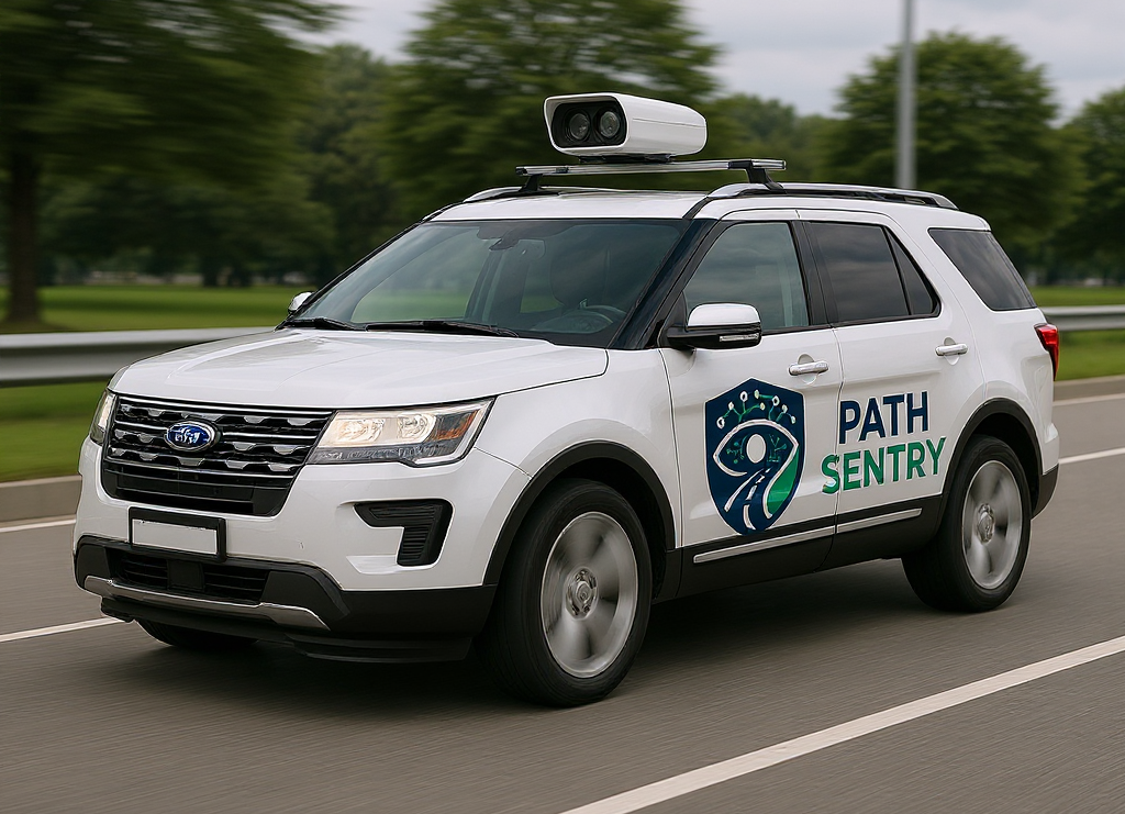
Is Your Road Maintenance Stuck in the Past?
The old way is slow, subjective, and unsafe. It's time for a smarter approach.
Subjectivity & Inconsistency
Human assessments vary, leading to unreliable data that makes it impossible to accurately track deterioration or prioritize repairs effectively.
Slow, Costly, & Risky
Manual inspections drain budgets and expose crews to live traffic hazards, all while critical defects are missed due to infrequent coverage.
Reactive "Whack-a-Mole" Repairs
Waiting for failures to occur leads to expensive emergency work, compromised public safety, and accelerated infrastructure decline.
Introducing Path Sentry
Intelligent, Automated Road Health at Your Fingertips
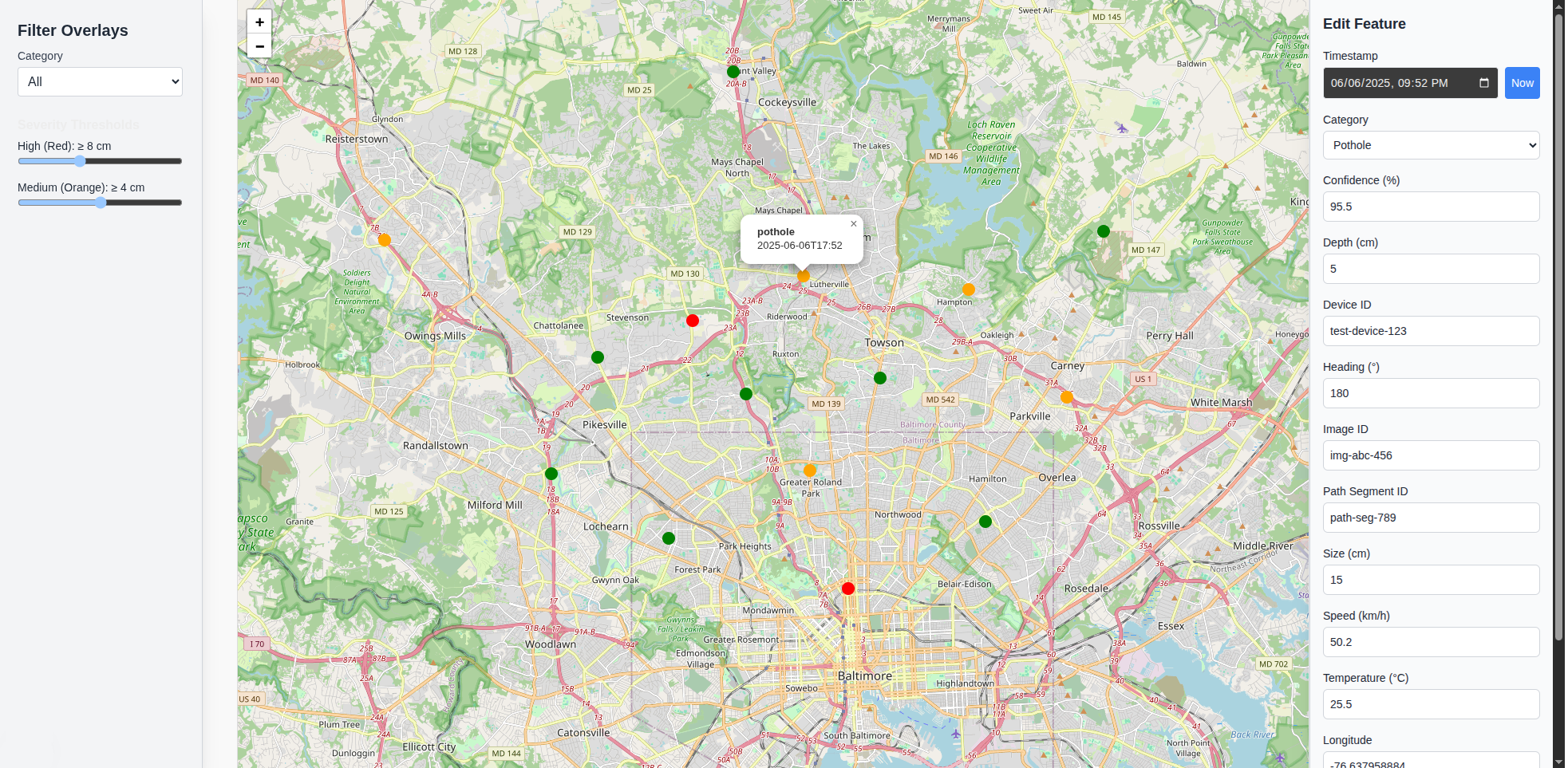
See Your Entire Network Clearly
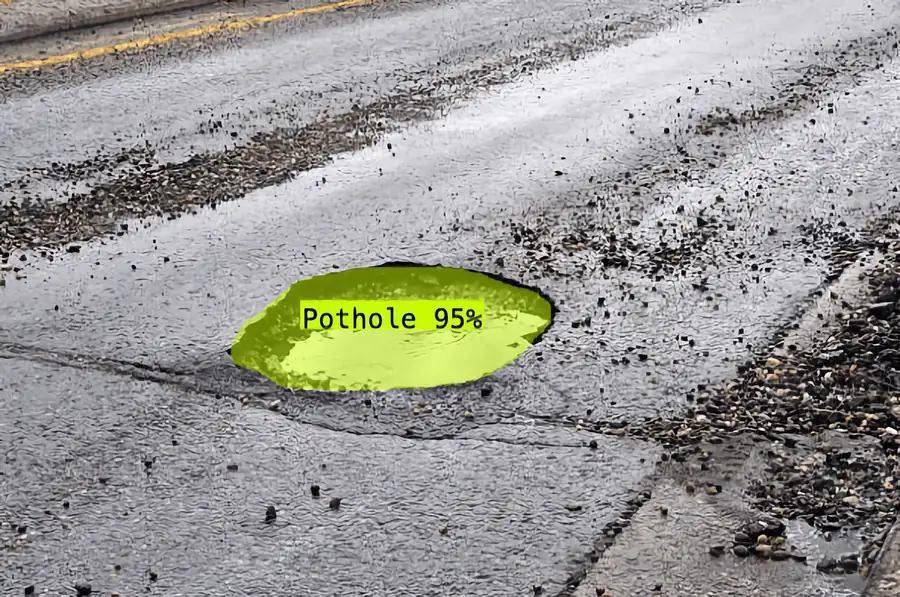
Gain a complete, unbiased, and consistent record of your entire road network's condition. Path Sentry utilizes advanced truck or drone-mounted LiDAR and high-resolution camera scanning technology. Our custom-trained computer vision models then automatically identify and classify a wide array of pavement distresses—including potholes, alligator cracks, spalling, and more—with superhuman accuracy and objectivity.
The Path Sentry Advantage
Drive Real Results with a Platform Built for Performance
Improve Safety
Significantly reduce the need for manual, on-foot inspections in high-traffic areas, protecting your crews by automating data collection.
Optimize Budgets
Shift from costly reactive repairs to proactive maintenance plans, maximizing the impact of every dollar spent and extending asset life.
Achieve Compliance
Deliver objective, auditable, and consistent data that meets stringent government reporting standards like COMAR and MAP-21.
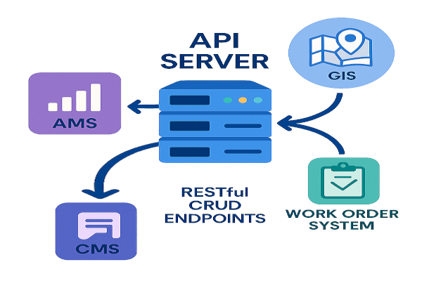
Built for Scale & Reliability
From a few miles to a thousand, our robust backend architecture ensures reliable operation and can grow with your agency's needs.
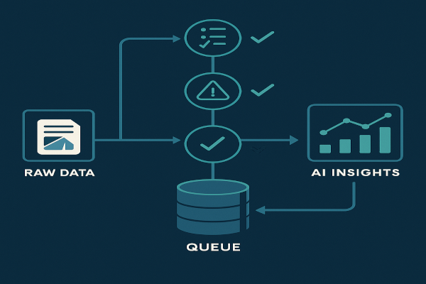
Unparalleled Data Trust
Our unique multi-rule validation engine and durable data queue ensure you make decisions based on exceptionally accurate data.
Quantifiable ROI
Visualize your potential savings and efficiency gains with data-driven insights that clearly demonstrate the return on investment.
A Solution for Every Stakeholder
Path Sentry is designed to meet the unique needs of every professional involved in infrastructure management.
Under the Hood: Technical Snapshot
A modern, robust, and enterprise-ready platform.
- Turnkey Solution: Full-stack platform from sensor to database.
- Secure & Modern Frontend: Next.js with React Leaflet for interactive mapping.
- Powerful API: Go-based server with full CRUD RESTful endpoints.
- Reliable Ingestion: Go-based edge server with validation engine & durable SQLite queueing.
- Enterprise-Ready Database: PostGIS for robust geospatial data storage.
- Easy & Secure Deployment: Caddy for automated HTTPS.
Ready to Revolutionize Your Road Maintenance?
See firsthand how Path Sentry can help your agency save time, reduce costs, and build a safer transportation network. Schedule a no-obligation demo with one of our infrastructure specialists today.
Request Your Live Demo NowHave questions? Contact us at sales@alta3.com